Introduction about Ph.D. in Geo-Informatics at Kashmir University
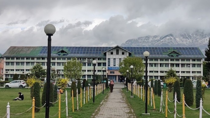
Embarking on a Ph.D. journey is more than just an academic pursuit; it is a commitment to pushing the boundaries of human knowledge. The Ph.D. in Geo-Informatics at Kashmir University offers a prestigious platform for researchers to explore the intricate intersection of geography, technology, and data science. Nestled in the heart of the Himalayas, the University of Kashmir provides an unparalleled natural laboratory for geospatial research. As the world grapples with climate change, rapid urbanization, and resource management challenges, the role of a Geo-Informatics specialist becomes vital. This program is designed to transform professionals into visionary researchers who can utilize satellite imagery, spatial modeling, and advanced analytics to solve real-world problems. Whether you are aiming to influence environmental policy or revolutionize urban planning, this doctorate serves as your gateway to high-impact leadership in the academic and industrial sectors.
Ph.D Admission 2026-2027 & Writing Support Services by Shiksha Research
Advanced research in this field often requires meticulous planning and execution. Scholars who find themselves balancing professional duties with academic rigor often seek expert Support. Navigating the complexities of research design can be streamlined by utilizing professional Thesis and Dissertation Writing Services to ensure that your scholarly work meets global standards of excellence.
Eligibility Criteria for Ph.D. in Geo-Informatics at Kashmir University
To join the cohort of elite researchers at the University of Kashmir, candidates must meet stringent academic requirements. The university seeks individuals with a robust foundation in geospatial sciences and a passion for innovation. The following eligibility criteria typically apply:
- Educational Qualification: Candidates must possess a Master?s degree in Geo-Informatics, Remote Sensing, GIS, Geography, Environmental Science, Physics, Mathematics, or a related field (such as Information Technology or Computer Science) from a recognized university.
- Minimum Percentage: A minimum of 55% marks (or an equivalent grade point average) at the post-graduation level is required. A relaxation of 5% is often provided to candidates belonging to reserved categories (SC/ST/OBC/Differently-abled) as per university and UGC guidelines.
- Professional Experience: While not always mandatory, professionals with relevant work experience in the GIS industry or research institutions are highly encouraged to apply, as their practical insights add immense value to the research environment.
- Academic Integrity: Candidates must demonstrate a clear aptitude for independent research and a commitment to the ethical standards of the university.
Entrance Exam for Ph.D. in Geo-Informatics at Kashmir University
Securing a seat in the Ph.D. program is a competitive process that begins with the Kashmir University Entrance Test (KUET). This exam is designed to evaluate the candidate's grasp of the subject matter and their research potential. The entrance exam usually consists of two parts:
- Research Methodology: Evaluation of the candidate?s understanding of research ethics, statistical tools, and data collection techniques.
- Subject-Specific Knowledge: Testing core concepts in Remote Sensing, Geographic Information Systems (GIS), Global Positioning Systems (GPS), and spatial analysis.
Candidates who have successfully cleared national-level examinations such as UGC-NET (including JRF), CSIR-NET, GATE, or SET are frequently exempted from the university-level entrance test, though they may still need to appear for the departmental interview. Preparing for the analytical portion of your research sometimes requires specialized assistance, particularly when handling complex datasets; in such cases, many scholars leverage Research Data Analysis Services to refine their findings.
Fee Structure for Ph.D. in Geo-Informatics at Kashmir University
The fee structure at Kashmir University is designed to be affordable while providing high-end laboratory facilities and access to premium geospatial software. Below is an approximate breakdown of the costs involved in the doctoral program:
| Fee Component | Approximate Amount (INR) | Frequency |
|---|---|---|
| Admission/Registration Fee | ?6,000 - ?10,000 | One-time |
| Tuition Fee | ?4,000 - ?6,000 | Per Semester |
| Laboratory & Infrastructure Fee | ?5,000 - ?8,000 | Annual |
| Library & Internet Fee | ?2,000 - ?3,000 | Annual |
| Thesis Submission/Evaluation Fee | ?10,000 - ?15,000 | One-time |
*Note: Fees are subject to revision by the university administration. It is advisable to check the official prospectus for the latest updates.*
Admission Process for Ph.D. in Geo-Informatics at Kashmir University
The path to becoming a doctoral scholar at the University of Kashmir is structured to ensure that only the most dedicated minds are selected. The process includes:
- Notification: The university issues an official advertisement on its website and in local/national newspapers calling for applications.
- Online Application: Prospective candidates must fill out the application form through the university's official portal and pay the requisite application fee.
- Entrance Testing: Eligible candidates appear for the entrance exam (unless qualifying for an exemption).
- Research Proposal & Interview: Shortlisted candidates are invited to present their research proposal before the Departmental Research Committee (DRC). This is where you demonstrate the originality and feasibility of your study.
- Final Selection: A composite merit list is prepared based on the entrance score, academic record, and interview performance. Successful candidates are then offered admission.
During the proposal stage, many students find that having a high-quality draft is essential. If you are struggling to articulate your vision, professional Research Paper Writing Services can provide the guidance needed to structure your preliminary papers and proposals effectively.
Ph.D. Subjects and Specializations in Geo-Informatics at Kashmir University
The Ph.D. program in Geo-Informatics is multidisciplinary, allowing students to specialize in areas that align with their career goals. Some of the core subjects and specialization paths include:
- Digital Image Processing: Advanced techniques for interpreting satellite images and aerial photography.
- Spatial Databases in GIS: Management and analysis of large-scale spatial data using SQL and specialized GIS software.
- Geostatistics: Applying mathematical models to analyze spatial variability and distribution.
- Cartography and Visualization: The science of representing complex data through intuitive and interactive maps.
- Global Navigation Satellite Systems (GNSS): Mastering precise positioning techniques for field data collection.
Research Areas in Geo-Informatics at Kashmir University
Kashmir University is specifically known for its research in fragile mountain ecosystems. Key research areas include:
- Glaciology & Hydrology: Monitoring glacial melt and managing water resources in the Himalayan region.
- Disaster Management: Using GIS to predict and mitigate the impact of landslides, floods, and earthquakes.
- Urban Growth & Land Use Change: Modeling the expansion of cities and their environmental footprint.
- Climate Change Impact Assessment: Analyzing long-term satellite data to observe climatic shifts.
- Precision Agriculture: Integrating geospatial technology to improve crop yields and soil health in the valley.
Many of these areas require robust field data collection. If your research involves surveys or social sensing, utilizing expert Questionnaire Design and Development tools can ensure your data collection instruments are valid and reliable.
Documents Required for Ph.D. in Geo-Informatics at Kashmir University
To ensure a smooth admission process, candidates should have the following documents ready:
- 10th and 12th Standard Marksheets and Certificates.
- Bachelor?s and Master?s Degree Degree Certificates and Transcripts.
- Migration/Transfer Certificate from the last attended institution.
- Character Certificate from the Head of the Department/Institution.
- Caste/Category Certificate (if applicable).
- UGC-NET/JRF/GATE/SET Qualification Certificate (for exemption seekers).
- Valid Government ID Proof (Aadhar Card, Passport, etc.).
- Initial Research Synopsis/Proposal (Draft).
- Passport-sized Photographs.
Kashmir University Ph.D. Syllabus for Geo-Informatics
While the Ph.D. is primarily research-oriented, students must complete a mandatory Course Work period, usually lasting one semester. The syllabus for this coursework includes:
- Unit 1: Research Methodology: Logic of scientific inquiry, literature review, and ethical methods in geospatial research.
- Unit 2: Advanced Geospatial Techniques: Exploration of LiDAR, Hyperspectral Remote Sensing, and advanced GIS algorithms.
- Unit 3: Computer Programming for GIS: Using Python or R to automate spatial analysis tasks.
- Unit 4: Statistical Methods: Probability distributions, hypothesis testing, and regression analysis specifically for spatial data.
How To Apply for Ph.D. in Geo-Informatics at Kashmir University
1. Visit the Official Website: Go to kashmiruniversity.net and navigate to the "Admissions" section.
2. Register: Create a new account using your email address and mobile number.
3. Complete Form: Fill in your personal, academic, and professional details accurately.
4. Upload Documents: Scan and upload the required documents in the prescribed format.
5. Payment: Pay the application fee online through the secure payment gateway.
6. Submit: Review all entries and submit the form. Keep a printed copy for future reference.
7. Submission of Synopsis: Depending on departmental rules, you may need to submit a hard copy of your preliminary research proposal to the department office.
Career Scope and Job Opportunities After Ph.D. in Geo-Informatics from Kashmir University
The demand for Geo-Informatics experts is surging globally. Professionals holding a Ph.D. from Kashmir University are highly sought after by various sectors:
- Academia: Join universities as Assistant Professors or Researchers, shaping the next generation of GIS professionals.
- Government Organizations: Work with ISRO, NRSC, Survey of India, or the Ministry of Environment and Forests.
- International Agencies: Secure positions in UN agencies, the World Bank, or international NGOs focusing on sustainability and disaster relief.
- Private Sector: High-level roles in tech giants like ESRI, Google (Earth/Maps), and specialized geospatial consultancy firms.
- R&D Centers: Lead innovation in autonomous vehicle mapping, precision farming, and smart city infrastructure.
A Ph.D. signifies your status as a subject matter expert, giving you the visionary authority to lead complex projects and influence global spatial policies.
Scholarship for Ph.D. in Geo-Informatics at Kashmir University
Financial support is available for meritorious and eligible scholars at the University of Kashmir:
- UGC-JRF/SRF: Candidates who have cleared the NET-JRF receive a substantial monthly fellowship from the University Grants Commission.
- University Research Scholarship: Kashmir University offers limited scholarships to non-NET/JRF candidates based on merit.
- Maulana Azad National Fellowship (MANF): For students from minority communities.
- Project Fellowships: Scholars may find opportunities to work as "Project Fellows" in funded research projects led by university professors, offering both experience and financial aid.
FAQs Regarding Ph.D. in Geo-Informatics at Kashmir University
1. What is the typical duration of the Ph.D. program?
The program generally takes between 3 to 6 years, depending on the research progress and thesis submission.
2. Can I pursue this Ph.D. on a part-time basis?
Kashmir University primarily offers full-time Ph.D. programs. However, inservice candidates may apply for "Part-time" Ph.D. status subject to university regulations and "No Objection Certificates" from their employers.
3. Is Geo-Informatics a good field for professional growth?
Absolutely. As spatial data becomes central to decision-making in every industry, having a doctorate in this field places you at the forefront of a high-growth, high-impact career path.
4. Is there an interview after the entrance exam?
Yes, candidates who pass the entrance exam or are exempted from it must appear for an interview or interaction where their research interests and aptitude are evaluated.
5. What software facilities are available at the university?
The university provides access to industry-standard software such as ArcGIS, ERDAS Imagine, ENVI, and various open-source platforms like QGIS and Grass GIS.